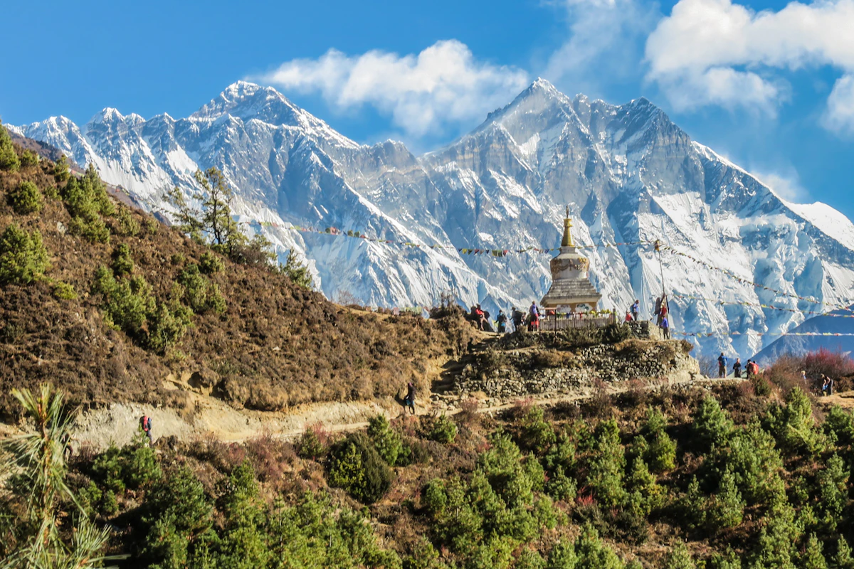
Overview & Route Narrative
Crowning the verdant spine of the Galiyat at 2,992 meters (9,816 feet), Miranjani is the highest summit in the Abbottabad district, famed for its scenic deodar forest ascent from Nathia Gali, breathtaking Tarbela Lake panoramas, and alpine ridgelines.
Standing as the supreme geographic apex of the Galiyat hill tract in Khyber Pakhtunkhwa, Miranjani Top crowns the Abbottabad district at an elevation of 2,992 meters (9,816 feet). Rising almost 200 meters higher than its popular sister peak, Mushkpuri (2,800m), Miranjani offers an invigorating, classic Himalayan ridge trek through ancient old-growth forests of Himalayan cedar (deodar), silver fir, and blue pine. Starting from the colonial hillstation of Nathia Gali near the historic Governor House and Namli Maira church, the trail climbs steadily along scenic forested crests, emerging onto windswept alpine pastures. At the summit crest, marked by the stone ruins of a British-era observation post, trekkers are rewarded with an immense 360-degree panorama: the glistening turquoise expanse of Tarbela Dam Lake and the Indus Valley to the west, the winding Jhelum River gorge and snowbound Pir Panjal range of Kashmir to the east, and on clear autumn days, the distant icy pyramid of Nanga Parbat (8,126m) glittering on the northern horizon.
Trek Highlights & Mountain Panorama
- Highest Summit in the Galiyat (2,992m): Stand at the true rooftop of the Abbottabad hills, conquering nearly 1,000 meters of vertical forest elevation gain.
- Unmatched 360-Degree Vistas: Behold the shimmering waters of Tarbela Lake, Abbottabad valley, Haripur plains, Circle Bakote, and Kashmir.
- Ancient Cedar & Pine Woodlands: Hike under centuries-old canopies of Himalayan deodar, silver fir, and horse chestnut filled with singing thrushes and birds of prey.
- Historic Namli Maira Pass: Walk past the picturesque alpine pass connecting Nathia Gali with the secluded mountain hamlets of Namli Maira and Bagnotar.
- Starting Point for the Thandiani Wilderness Traverse: Gateway to the famous 30-kilometer, 2-day wilderness backpacking trek along the forested ridge to Thandiani.
The Trail Breakdown: Nathia Gali to Miranjani Summit
The trek to Miranjani Top covers approximately 9.5 kilometers round-trip, taking 2.5 to 3.5 hours for the ascent and 1.5 to 2 hours for the descent:
- Stage 1: Trailhead to Forest Rest Point (2 km / 1 Hour): The trail begins near the historic Governor House in Nathia Gali (2,250m). A well-defined dirt and stone path ascends beneath towering deodar trees and wild blackberry brambles. Early morning hikes offer crisp, pine-scented mountain air and sightings of gray langurs and flying squirrels.
- Stage 2: Namli Maira Col to High Ridge (1.5 km / 1 Hour): The trail emerges onto a grassy mountain saddle (col) overlooking the valley of Namli Maira. The gradient steepens as the path negotiates rocky switchbacks and open pastures where local herders graze livestock in summer.
- Stage 3: The Summit Ridge Push (1.2 km / 45 Mins): The final stretch ascends an exposed, breezy ridgeline above the tree line. The ground is carpeted in wild alpine clover and yellow buttercups. Passing the old stone watchtower ruins, hikers reach the summit trig point (2,992m) for sweeping views stretching over 60 miles in every direction.
| Trek Segment | Elevation | Distance / Time | Terrain Character |
|---|---|---|---|
| Nathia Gali (Trailhead) | 2,250m | Starting Point | Paved hill road, pine woods, car parking |
| Namli Maira Forest Saddle | 2,600m | 2.0 km / 1.0 Hour | Shaded deodar trail, mountain springs |
| Upper Grassy Switchbacks | 2,800m | 1.5 km / 1.0 Hour | Rocky dirt track, open hillside vistas |
| Miranjani Summit Apex | 2,992m | 1.2 km / 45 Minutes | Open alpine ridge, 360° summit panorama |
| Descent to Nathia Gali | 2,250m | 4.7 km / 1.5 - 2 Hours | Gradual downhill trail back to hotels |
Miranjani vs Mushkpuri: Which Trek to Choose?
While both peaks are accessed from Nathia Gali, they offer contrasting trekking experiences. Mushkpuri (2,800m) is shorter (4 km), more gradual, and features an expansive, rolling flat meadow top ideal for casual walkers, families, and young children. Miranjani (2,992m) is noticeably steeper, longer (4.7 km one-way with 740m vertical gain), and reaches a higher, more dramatic rocky peak that appeals to hiking enthusiasts seeking a genuine cardiovascular challenge and broader panoramic vistas.
Safety & Preparation Guidelines
Wear sturdy hiking boots or trail sneakers with good lugged tread, as the exposed dirt switchbacks can be slippery following mountain showers. Bring at least 1.5 to 2 liters of water, as there are no clean water sources along the upper ridge. In winter (December to March), snowdrifts along the summit ridge can reach 3 to 5 feet, requiring warm insulated boots, micro-spikes, and trekking poles.
Planning an alpine ridge hike in the Galiyat? We coordinate private transport from Islamabad, local mountain escorts, and customized day itineraries with our Custom Pakistan Tours team.
Transparent Pricing Plan
Our pricing plan for Miranjani Top Trek (Highest Peak in Galiyat, 2,992m) (Day Hike (4 to 5 Hours Round-Trip)) includes verified transport, campsite staging, full chef-prepared meals, and expert mountain guiding with zero hidden logistical fees.
| Group Size / Traveling Party | Rate per Person (USD) | Logistics & Package Tier |
|---|---|---|
| 1 - 2 Travelers (Private) | $220 / person | Full Private Concierge |
| 3 - 5 Travelers (Small Group) | $187 / person | Save $33 / pax |
| 6 - 9 Travelers (Family / Friends) | $158 / person | Save $62 / pax |
| 10+ Travelers (Private Group Charter) | $136 / person | Best Value Guaranteed |
Key Sights & Experiences
Ascend to the highest summit in the Galiyat at 2,992 meters, standing at the geographic crown of Abbottabad
Gaze upon the colossal shimmering expanse of Tarbela Dam Lake and the distant snow peak of Nanga Parbat (8,126m)
Hike through pristine old-growth forests of Himalayan cedar, silver fir, and fragrant blue pine
Explore the historic British-era colonial stone watchtower ruins on the windswept summit crest
Experience a rewarding, invigorating 9.5km round-trip mountain hike directly from the hill resort of Nathia Gali
Detailed Trip Itinerary
Each stage has been carefully paced for altitude safety, acclimatization, scenic exploration, and comfortable wilderness camps or premium hotels.
The trail begins near the historic Governor House in Nathia Gali (2,250m). A well-defined dirt and stone path ascends beneath towering deodar trees and wild blackberry brambles. Early morning hikes offer crisp, pine-scented mountain air and sightings of gray langurs and flying squirrels.
The trail emerges onto a grassy mountain saddle (col) overlooking the valley of Namli Maira. The gradient steepens as the path negotiates rocky switchbacks and open pastures where local herders graze livestock in summer.
The final stretch ascends an exposed, breezy ridgeline above the tree line. The ground is carpeted in wild alpine clover and yellow buttercups. Passing the old stone watchtower ruins, hikers reach the summit trig point (2,992m) for sweeping views stretching over 60 miles in every direction.
What's Included in the Tour Cost
- Licensed government mountain guide, cook, and professional field crew
- All domestic mountain flights (Islamabad-Skardu/Gilgit) or private 4x4 AC Prado/Coaster
- Deluxe hotel accommodations & alpine twin-sharing four-season camping tents
- All meals on trail (Hot breakfast, packed/warm lunches, multi-course nutritious dinners)
- Full camping logistics: Mess tent, dining tables, stools, kitchen tent & private toilet tents
- Porterage allowance of personal duffel bags (up to 15kg - 20kg per traveler)
- All national park conservation fees, bridge tolls, and official wilderness trek permits
- Emergency wilderness first aid medical kit & satellite SOS tracking communications
What's Not Included
- International round-trip flights to and from Islamabad International Airport (ISB)
- Pakistan single-entry or multiple-entry tourist visa application fees
- Mandatory travel, medical emergency, and high-altitude helicopter rescue insurance
- Personal climbing or trekking equipment (down jacket, sleeping bag, trekking poles)
- Discretionary tips & gratuities for mountain guides, camp cooks, and porter team
- Personal laundry, beverages, minibar, and personal satellite phone call charges
Gear, Packing & Mountain Safety
High mountain travel in Pakistan is an unforgettable adventure when properly prepared. We equip every expedition with certified local guides, comprehensive wilderness first-aid kits, and satellite SOS communicators.
Acclimatization & Hydration
Follow the golden mountain rule: climb high, sleep low. Maintain daily hydration of 3 to 4 liters of clean water and communicate any symptoms of AMS with your guide immediately.
Essential Mountain Layering
Pack in three layers: moisture-wicking base merino, insulating fleece/down mid-layer, and a 100% waterproof/windproof Gore-Tex outer shell. Sturdy broken-in hiking boots are essential.
Permits & Leave No Trace
All official DTS security clearances and National Park wilderness permits are handled by our office. We adhere strictly to Leave No Trace principles—carrying out all camp waste.
Frequently Asked Questions
How difficult is the Miranjani trek compared to Mushkpuri?
Miranjani is somewhat steeper and more strenuous than Mushkpuri. It ascends roughly 740 vertical meters over 4.7 kilometers, taking about 3 hours up. While manageable for any reasonably fit walker, it requires more stamina and cardio endurance than the gentler Mushkpuri trail.
How long does the round-trip hike take?
A typical round-trip hike takes between 4 and 5 hours in total: 2.5 to 3 hours for the ascent, 30 to 45 minutes at the summit enjoying views and snacks, and 1.5 hours for the descent.
Can you see Tarbela Lake and Nanga Parbat from Miranjani?
Yes. Miranjani offers unobstructed western views where the vast blue waters of Tarbela Lake and the Indus basin are clearly visible on sunny days. On clear, crisp mornings, the distant snowbound summit of Nanga Parbat (8,126m) can be spotted on the far northern horizon.
Are horses available for the Miranjani trek?
Horses can be hired at the Nathia Gali trailhead to ride as far as the Namli Maira saddle or the lower forest ridge. However, the final steep, rocky switchbacks to the summit monument are best completed on foot.
Is the trail safe for solo hikers and women?
Yes. Miranjani is a very popular, well-trodden trail frequented on weekends by university groups, families, and hiking clubs. It is safe and welcoming, though hiking with a partner or group is always recommended in mountain environments.
What is the best season to hike Miranjani Top?
May through October offers pleasantly cool weather (15°C to 22°C) and lush green meadows. October and November provide the clearest skies and best visibility for distant mountain panoramas. December to March brings beautiful snow-trekking conditions.
Inquire / Book Miranjani Top Trek (Highest Peak in Galiyat, 2,992m)
Complete the form below to receive detailed departure dates, tailored vehicle/porter logistics, and an all-inclusive custom quote within 24 hours.