
Essential Destination Profile: Miranjani Peak (2,992m): Highest Summit in the Galiyat
About Miranjani Peak (2,992m): Highest Summit in the Galiyat
Rising majestically as the crowning monarch of the Lesser Himalaya in Abbottabad District, Miranjani Peak (2,992m / 9,816 ft) is the highest mountain summit in the entire Galiyat range. Towering directly behind the colonial hill station of Nathia Gali, Miranjani has been a celebrated hiking destination since the British colonial era of the late 19th century. The historic trail—originally engineered as an alpine bridle path by British forest officers—begins near the historic Governor House in Nathia Gali (at 2,400m) and ascends through ancient, aromatic old-growth temperate forests of Himalayan blue pine (Pinus wallichiana), silver fir, and horse chestnut trees. Emerging above the forest canopy onto the undulating subalpine crest, hikers are greeted by expansive grassy pastures carpeted with wild yellow buttercups, daisies, and Himalayan anemones. On crisp, clear mornings, the rocky summit of Miranjani delivers an astonishing 360-degree geographic panorama: looking north across the Hazara hills, the colossal snow-covered apex of Nanga Parbat (8,126m) shimmers 150 kilometers away; to the east gleams the silver ribbon of the Jhelum River and the snow-capped Pir Panjal mountains of Kashmir; and to the south unfold the green ridges of Murree and the Margalla Hills framing Islamabad.
Miranjani Peak: Key Trail Metrics & Physical Profile
- Summit Elevation: 2,992 meters (9,816 feet) above sea level—the highest elevation in the Galiyat hills.
- Elevation Gain: Approximately 600 meters (1,970 feet) of steady, non-technical ascent from trailhead to crest.
- Trailhead Location: Primary route starts near Governor House / St. Matthew's Church road in Nathia Gali (2,400m); alternative southern approach from Namli Maira village.
- Hiking Distance & Duration: 4.5 km each way (9 km round-trip); takes 2.5 to 3.5 hours up, 1.5 to 2 hours down.
- Forest Ecology: Dense old-growth temperate moist forest; home to common leopards, barking deer, rhesus macaques, and monal pheasants.
- Historic Wilderness Ridge Connection: Launchpad for the legendary 2-day wilderness ridge trek from Nathia Gali through Dagri Bangla (rest house ruins) to Thandiani.
Waypoint-by-Waypoint Trail Navigation Profile
The hike from Nathia Gali to the summit of Miranjani is well-defined and straightforward, dividing naturally into distinct elevation waypoints:
| Trail Milestone & Waypoint | Altitude | Distance from Start | Time Required | Terrain & Route Character |
|---|---|---|---|---|
| Nathia Gali Trailhead | 2,400m (7,874 ft) | 0.0 km | Start | Paved road ends near Governor House gate / Forest Rest House; broad dirt bridle trail begins under dense pine canopy. |
| British Water Catchment & Forest Switchbacks | 2,600m (8,530 ft) | 1.8 km | 45 – 60 min | Historic stone water storage tank; trail winds through cool, shaded switchbacks bordered by mossy rocks and ferns. |
| Hawa Wali Choti (Windy Knoll Meadow) | 2,820m (9,250 ft) | 3.2 km | 1.5 – 2 Hours | Trees thin out into open subalpine grass slopes; refreshing mountain breeze and first panoramic views over Abbottabad valley. |
| False Summit & Ridge Crest | 2,940m (9,645 ft) | 4.0 km | 2.2 – 2.8 Hours | Gentle ridge traverse along the open mountain spine; sweeping vistas of Kashmir hills to the east. |
| Miranjani Peak Summit | 2,992m (9,816 ft) | 4.5 km | 2.5 – 3.5 Hours | Stone cairn and survey marker; magnificent 360-degree panorama of Nanga Parbat, Pir Panjal, and Jhelum River. |
| Return Descent to Nathia Gali | 2,400m (7,874 ft) | 9.0 km (Total) | 1.5 – 2 Hours | Comfortable shaded downhill return along the same forest track. |
Side-by-Side Comparison: Miranjani vs. Mukshpuri vs. Pipeline Track
To choose the right hike for your fitness level, compare the three signature trails of the Galiyat:
| Feature / Metric | Miranjani Peak | Mukshpuri Peak | Pipeline Track |
|---|---|---|---|
| Summit Elevation | 2,992m (9,816 ft) — Highest point | 2,800m (9,200 ft) | 2,400m (Flat contour) |
| Round-Trip Distance | 9.0 km (4.5 km one way) | 6.5 km (from Nathia Gali) | 8.0 km (4 km each way) |
| Total Elevation Gain | ~600 meters | ~400 meters | Virtually flat (<50m) |
| Trek Difficulty | Moderate (Consistent uphill grade) | Easy to Moderate | Very Easy (Family nature walk) |
| Summit Views | Nanga Parbat (8,126m), Kashmir, Tarbela basin | Pir Panjal, Murree hills, rolling meadows | Forest valley views, Ayubia canyon |
| Best Suited For | Hiking enthusiasts, fit beginners, photographers | Families, casual hikers, picnic lovers | Elderly travelers, strollers, nature strolls |
Practical Trail Planning, Gear & Hydration Rules
Preparation ensures a safe, rewarding summit experience on Miranjani:
- No Fresh Water Sources on Trail: There are no natural springs, tea stalls, or water refill points once you pass the lower forest. Every hiker must carry at least 1.5 to 2 litres of drinking water per person.
- Start Early to Beat the Clouds: During summer (June to August), convective moisture builds by early afternoon. To guarantee clear summit views of Nanga Parbat and avoid afternoon rain, start the hike no later than 08:30 AM from Nathia Gali.
- Trekking Poles & Footwear: While the trail is non-technical, sturdy trail running shoes or hiking boots with rubber lug soles prevent slipping on loose dirt and damp pine needles. Trekking poles significantly reduce knee impact during the 600m descent.
- Monsoon Caution: In July and August, sections of the upper meadow become slippery mud. Pack a lightweight waterproof rain shell and pack cover.
- Winter Snow Hikes (December to March): The trail is blanketed under deep snow. Snowshoes or microspikes and warm thermal base layers are essential for winter ascents.
- Multi-Day Ridge Extension to Dagri Bangla & Thandiani: Seasoned backpackers can continue past Miranjani along the crest for 13 km to the historic Dagri Bangla colonial forest rest house, and onward on day two to Thandiani—one of Pakistan's finest heritage ridge backpacking trails.
Planning an extended hiking trip across Khyber Pakhtunkhwa? Check out our Pakistan Trekking Tours or request a personalized hiking itinerary through our Custom Pakistan Tours desk.
Key Highlights & Geographic Significance
Tours & Treks in Miranjani Peak (2,992m): Highest Summit in the Galiyat
Handcrafted guided departures, private 4x4 road journeys, and alpine trekking routes exploring Miranjani Peak (2,992m): Highest Summit in the Galiyat and the wider Khyber Pakhtunkhwa mountain corridor.
 Tour Package 5 Days / 4 Nights
 5-Day Swat, Kalam & Malam Jabba Scenic Tour Package
Discover Pakistan's 'Switzerland of the East' on our signature 5-day private tour. Ride the chairlifts at Malam Jabba ski resort, explore ancient Gandhara Buddhist stupas, and take a 4x4 jeep safari through Ushu Forest to turquoise Mahodand Lake.
 Tour Package 1-Day Day Trips to 3-Day Weekend River Expeditions
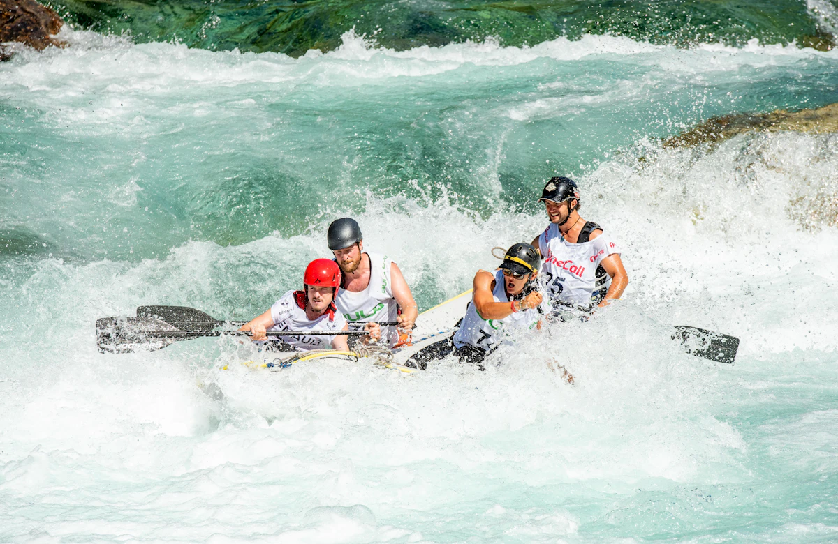
 Whitewater Rafting in Pakistan: Glacial Rapids on Kunhar, Indus, Neelum & Swat Rivers
Conquer exhilarating Grade II to IV+ glacial rapids on Pakistan's premier river runs: the foaming Kunhar River in Kaghan, the emerald Swat River, pine-lined Neelum River in Kashmir, and massive big-water gorges of the upper Indus near Skardu.
 Trekking Route 3 Days / 2 Nights
 Galiyat 3-Trek Alpine Challenge: Mushkpuri, Miranjani & Pipeline Track (3 Days)
Conquer Galiyat's three most celebrated alpine trails in a single weekend: summit Miranjani Peak (2,992m), ascend the wildflower meadows of Mushkpuri Top (2,800m), and stroll the historic 1891 Ayubia Pipeline Track.
Trekking Route Day Hike (4 to 5 Hours Round-Trip) Miranjani Top Trek (Highest Peak in Galiyat, 2,992m)
Crowning the verdant spine of the Galiyat at 2,992 meters (9,816 feet), Miranjani is the highest summit in the Abbottabad district, famed for its scenic deodar forest ascent from Nathia Gali, breathtaking Tarbela Lake panoramas, and alpine ridgelines.
Design a Custom Miranjani Peak (2,992m): Highest Summit in the Galiyat Itinerary
Have specific dates, private group preferences, or combining multiple valleys across Khyber Pakhtunkhwa? Our mountain logistics desk crafts tailored private 4x4 departures.
- Private 4x4 Toyota Prado / Land Cruiser convoy
- Certified local mountain guides & porters
- Curated heritage lodges & boutique camps
Frequently Asked Questions About Miranjani Peak (2,992m): Highest Summit in the Galiyat
How long does it take to hike to the top of Miranjani Peak?
The hike to the summit of Miranjani (2,992m) takes between 2.5 and 3.5 hours at a steady, moderate pace. The return descent back to Nathia Gali takes about 1.5 to 2 hours. The total round-trip distance is approximately 9 kilometers.
Where does the Miranjani hiking trail start?
The primary and most popular trailhead starts behind the historic Governor House and St. Matthew's Church area on the upper road in Nathia Gali (at 2,400m). An alternate secondary trail ascends from the village of Namli Maira.
Which hike is harder: Miranjani or Mukshpuri?
Miranjani is somewhat harder and longer than Mukshpuri. Miranjani rises to 2,992m with approximately 600m of elevation gain over a 9km round-trip, taking 4 to 5 hours. Mukshpuri tops out at 2,800m with about 400m of elevation gain over 6.5km, taking 2.5 to 3 hours. Hikers seeking a relaxed climb often choose Mukshpuri, while those wanting higher elevation and summit views prefer Miranjani.
Is water or food available on the Miranjani trail?
No. Once you leave the Nathia Gali roadhead, there are no commercial tuck shops, water taps, or clean drinking springs along the trail. Every hiker must carry at least 1.5 to 2 litres of drinking water and trail snacks in their daypack.
What time of day is best to start the Miranjani trek?
The ideal time to start is early morning between 08:00 AM and 09:00 AM. Starting early ensures cooler hiking temperatures and maximizes the probability of crisp, cloud-free summit views toward Nanga Parbat and Kashmir before afternoon clouds roll in.
Is Miranjani safe for solo hikers, female travelers, and families?
Yes. Miranjani is one of the safest and most popular mountain trails in Pakistan, frequently visited by families, student groups, and solo travelers. The path is broad and well-trodden. Local guides can also be hired at the Nathia Gali trailhead for added guidance.