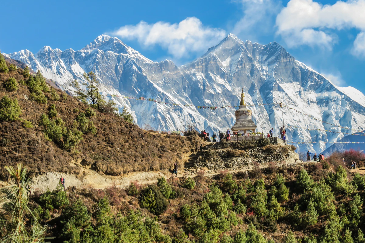
Overview & Route Narrative
Traverse the legendary British colonial high ridge trail of the Lesser Himalayas: a rewarding 3-day alpine backpacking trek from Thandiani to Nathia Gali through ancient deodar forests, Dagri Bangla, and Beran Gali.
Winding along the misty, cloud-draped spine of the Lesser Himalayas in Khyber Pakhtunkhwa's Abbottabad District, the Thandiani to Nathia Gali Trek (2,750m / 9,022 ft) is universally celebrated as the most iconic, historically romantic, and biologically diverse multi-day ridge backpacking hike in Pakistan. Carved in the late 19th century by British colonial foresters and survey officers to connect the cool hill stations of Thandiani ('The Cold Place', 2,700m) with Nathia Gali (2,500m), this classic 36-kilometer trail follows an unbroken mountain crest separating the Kunhar River valley from the Abbottabad plains. Hikers walk beneath an ancient, cathedral-like canopy of centuries-old Himalayan deodar cedars, towering silver firs, and moss-draped horse chestnut trees. The journey is famously anchored by overnight stops at historic colonial dak bungalows—most celebratedly the legendary wooden rest house of Dagri Bangla (2,720m)—and offers sweeping panoramas looking east toward the snow-capped Pir Panjal Range in Kashmir and northwest toward the jagged granite crests of Kohistan and the distant colossus of Nanga Parbat.
Trek Highlights & Himalayan Ridge Wonders
- Classic 3-Day Himalayan Ridge Backpacking: A 36-kilometer ridge traverse linking two premier hill stations across unspoiled wilderness.
- Cathedral Deodar & Cedar Canopies: Walk through some of the densest, most ancient primary temperate forests remaining in Pakistan.
- Historic Colonial Dak Bungalows: Camp beside the atmospheric 19th-century rest houses of Beran Gali and the iconic wooden mansion of Dagri Bangla (2,720m).
- Rich Wildlife Sanctuary: Inhabit the natural sanctuary of common leopards, barking deer, flying squirrels, and exotic Himalayan monal pheasants.
- Panoramic Kashmir & Hazara Vistas: Gaze directly across the Jhelum River basin toward the snow peaks of Azad Kashmir and the rolling Hazara foothills.
- Accessible Wilderness Escape: Located merely 2.5 hours from Islamabad, offering a true wilderness backpacking experience without requiring high-altitude flights.
Day-by-Day Trekking Guide: Thandiani to Nathia Gali
The trek covers 36 kilometers across 3 well-paced days:
- Day 1: Islamabad / Abbottabad to Thandiani & Beran Gali (2,150m): Depart Islamabad via the Hazara Motorway (M-15) to Abbottabad (2 hours). Ascend the scenic 24-kilometer mountain road to the pine-clad hill station of Thandiani (2,700m). Meet local mountain porters and begin the hike. The trail immediately plunges into dense pine woods, following an easy downhill and contouring path along the eastern ridge. Cross gentle streams and grassy glades to reach the colonial forest rest house at Beran Gali (2,150m / 4 hours). Pitch camp or stay in local guest huts. Evening bonfire and stargazing. Walking distance: 11 km.
- Day 2: Beran Gali to Dagri Bangla (2,720m): Known as the most demanding yet rewarding section of the trek. The trail climbs steadily out of Beran Gali through dense oak and spruce forests, gaining roughly 600 vertical meters. As you gain elevation, the trail enters magnificent stands of giant deodar trees, known locally as 'Dagri' (meaning 'The Place of Big Trees' in the local Hindko dialect). Arrive at the evocative ruins and grassy lawns of Dagri Bangla (2,720m), perched dramatically on a high ridge saddle. Pitch wilderness tents on the lawn, watching the golden sunset bathe the Kashmir mountains. Walking distance: 13 km / 5 to 6 hours.
- Day 3: Dagri Bangla to Miranjani Base & Nathia Gali (2,500m): An exhilarating morning ridge walk through moss-covered birch and fir woodlands. The trail contours along the high watershed, offering bird's-eye views of the Abbottabad valley to the west and the Jhelum River to the east. Pass the junction trail leading to the summit of Miranjani Peak (2,992m). Continue the gentle descent through fragrant blue pine glades, emerging into the historic colonial bazaar of Nathia Gali (near Saint Matthew's Church). Celebrate with hot tea and a hearty meal before boarding private transport back to Islamabad. Walking distance: 12 km / 4 to 5 hours.
| Trek Stage | Altitude | Distance / Time | Terrain & Visual Features |
|---|---|---|---|
| Thandiani Trailhead | 2,700m | Starting Point | Colonial hill station, pine glades, ridge entrance |
| Beran Gali Rest House | 2,150m | 11 km / 4.0 Hours | Gentle descent, pastoral hamlets, oak woodland |
| Dagri Ridge Ascent | 2,500m | 7 km / 3.0 Hours | Steep forested switchbacks, ancient cedar trees |
| Dagri Bangla Campsite | 2,720m | 6 km / 2.5 Hours | High mountain saddle, historic wooden bungalow |
| Miranjani Ridge Path | 2,650m | 7 km / 2.5 Hours | Narrow ridge path, panoramic Kashmir vistas |
| Nathia Gali Terminus | 2,500m | 5 km / 2.0 Hours | Gentle descent into central Galiyat town |
Comparing Thandiani-Nathia Gali with Other Galiyat Trails
Understanding how this multi-day traverse compares to popular day hikes in the Galiyat region:
| Trail Name | Trek Type | Duration | Max Altitude | Wilderness Experience |
|---|---|---|---|---|
| Thandiani to Nathia Gali | Multi-Day Ridge Backpacking | 3 Days (36 km) | 2,750m | True wilderness, camping, zero commercial crowds |
| Miranjani Peak Hike | Day Hike (Return) | 4 to 5 Hours (9 km) | 2,992m | Popular weekend hike, moderate crowds |
| Mushkpuri Peak Hike | Day Hike (Return) | 3 to 4 Hours (7 km) | 2,800m | Very popular family hike, lush meadows |
| Ayubia Pipeline Track | Completely Flat Nature Walk | 2 Hours (4 km) | 2,500m | Family boardwalk trail, high tourist foot traffic |
Essential Tips: Water, Camping & Guides
The ideal trekking season is May through October. July and August bring misty monsoons with lush greenery and blooming wild ferns, while September and October feature crisp, crystal-clear blue skies. Water Caution: Water springs along the ridge are seasonal; hikers must carry at least 2 to 3 liters of water per person between camps and use purification tablets. Local Guides: While the trail is generally well-defined, dense fog often blankets the ridges; hiring a local guide from Abbottabad or Thandiani is strongly advised for navigation and campsite assistance.
Transparent Pricing Plan
Our pricing plan for Thandiani to Nathia Gali Ridge Trek (Galiyat High Trail, 2,750m) (3 Days / 2 Nights) includes verified transport, campsite staging, full chef-prepared meals, and expert mountain guiding with zero hidden logistical fees.
| Group Size / Traveling Party | Rate per Person (USD) | Logistics & Package Tier |
|---|---|---|
| 1 - 2 Travelers (Private) | $380 / person | Full Private Concierge |
| 3 - 5 Travelers (Small Group) | $323 / person | Save $57 / pax |
| 6 - 9 Travelers (Family / Friends) | $274 / person | Save $106 / pax |
| 10+ Travelers (Private Group Charter) | $236 / person | Best Value Guaranteed |
Key Sights & Experiences
Complete the legendary 36-kilometer British colonial ridge backpacking traverse from Thandiani to Nathia Gali
Hike through ancient, cathedral-like primary temperate forests of giant deodar cedar, silver fir, and horse chestnut
Camp under starlit Himalayan skies beside the historic 19th-century colonial wooden rest house of Dagri Bangla (2,720m)
Enjoy sweeping bird's-eye panoramas spanning the snow peaks of Kashmir, the Jhelum River gorge, and Hazara plains
Experience a true wilderness multi-day backpacking adventure located just 2.5 hours from Islamabad via modern motorways
Detailed Trip Itinerary
Each stage has been carefully paced for altitude safety, acclimatization, scenic exploration, and comfortable wilderness camps or premium hotels.
Depart Islamabad via the Hazara Motorway (M-15) to Abbottabad (2 hours). Ascend the scenic 24-kilometer mountain road to the pine-clad hill station of Thandiani (2,700m). Meet local mountain porters and begin the hike. The trail immediately plunges into dense pine woods, following an easy downhill and contouring path along the eastern ridge. Cross gentle streams and grassy glades to reach the colonial forest rest house at Beran Gali (2,150m / 4 hours). Pitch camp or stay in local guest huts. Evening bonfire and stargazing. Walking distance: 11 km.
Known as the most demanding yet rewarding section of the trek. The trail climbs steadily out of Beran Gali through dense oak and spruce forests, gaining roughly 600 vertical meters. As you gain elevation, the trail enters magnificent stands of giant deodar trees, known locally as 'Dagri' (meaning 'The Place of Big Trees' in the local Hindko dialect). Arrive at the evocative ruins and grassy lawns of Dagri Bangla (2,720m), perched dramatically on a high ridge saddle. Pitch wilderness tents on the lawn, watching the golden sunset bathe the Kashmir mountains. Walking distance: 13 km / 5 to 6 hours.
An exhilarating morning ridge walk through moss-covered birch and fir woodlands. The trail contours along the high watershed, offering bird's-eye views of the Abbottabad valley to the west and the Jhelum River to the east. Pass the junction trail leading to the summit of Miranjani Peak (2,992m). Continue the gentle descent through fragrant blue pine glades, emerging into the historic colonial bazaar of Nathia Gali (near Saint Matthew's Church). Celebrate with hot tea and a hearty meal before boarding private transport back to Islamabad. Walking distance: 12 km / 4 to 5 hours.
What's Included in the Tour Cost
- Licensed government mountain guide, cook, and professional field crew
- All domestic mountain flights (Islamabad-Skardu/Gilgit) or private 4x4 AC Prado/Coaster
- Deluxe hotel accommodations & alpine twin-sharing four-season camping tents
- All meals on trail (Hot breakfast, packed/warm lunches, multi-course nutritious dinners)
- Full camping logistics: Mess tent, dining tables, stools, kitchen tent & private toilet tents
- Porterage allowance of personal duffel bags (up to 15kg - 20kg per traveler)
- All national park conservation fees, bridge tolls, and official wilderness trek permits
- Emergency wilderness first aid medical kit & satellite SOS tracking communications
What's Not Included
- International round-trip flights to and from Islamabad International Airport (ISB)
- Pakistan single-entry or multiple-entry tourist visa application fees
- Mandatory travel, medical emergency, and high-altitude helicopter rescue insurance
- Personal climbing or trekking equipment (down jacket, sleeping bag, trekking poles)
- Discretionary tips & gratuities for mountain guides, camp cooks, and porter team
- Personal laundry, beverages, minibar, and personal satellite phone call charges
Gear, Packing & Mountain Safety
High mountain travel in Pakistan is an unforgettable adventure when properly prepared. We equip every expedition with certified local guides, comprehensive wilderness first-aid kits, and satellite SOS communicators.
Acclimatization & Hydration
Follow the golden mountain rule: climb high, sleep low. Maintain daily hydration of 3 to 4 liters of clean water and communicate any symptoms of AMS with your guide immediately.
Essential Mountain Layering
Pack in three layers: moisture-wicking base merino, insulating fleece/down mid-layer, and a 100% waterproof/windproof Gore-Tex outer shell. Sturdy broken-in hiking boots are essential.
Permits & Leave No Trace
All official DTS security clearances and National Park wilderness permits are handled by our office. We adhere strictly to Leave No Trace principles—carrying out all camp waste.
Frequently Asked Questions
Where does the Thandiani to Nathia Gali trek start and finish?
The trek starts at the scenic hill station of Thandiani (2,700m), located 24 km northeast of Abbottabad, and finishes in the central town of Nathia Gali (2,500m) in the Galiyat region.
How long does the Thandiani to Nathia Gali trek take?
The trek is 36 kilometers long and is traditionally completed over 3 days (2 nights): Day 1 covers 11 km from Thandiani to Beran Gali; Day 2 covers 13 km from Beran Gali to Dagri Bangla; and Day 3 covers 12 km from Dagri Bangla into Nathia Gali.
What is Dagri Bangla and why is it famous?
Dagri Bangla is a historic British colonial forest rest house built in the late 19th century at an altitude of 2,720 meters. Situated in an enchanting clearing surrounded by colossal Himalayan deodar trees (hence the name 'Dagri', meaning place of big trees), it is one of the most famous wilderness campsites in Northern Pakistan.
Are there hotels or food along the trail?
No. The trail passes through protected wilderness with no commercial hotels, shops, or restaurants. Trekkers must carry their own tents, sleeping bags, cooking gear, and food supplies, or hire local guides and porters to arrange wilderness logistics.
Is drinking water easily available on the ridge?
Water springs along the ridge are limited and seasonal. Reliable water sources exist at Beran Gali and about 15 minutes below Dagri Bangla. Trekkers must carry sufficient water bottles and use water purification tablets or filters.
How do we get back to Islamabad after finishing in Nathia Gali?
Nathia Gali is connected to Islamabad via the paved Murree Expressway (N-75) and Galiyat road. Private cars, vans, or public transport can drive you from Nathia Gali back to Islamabad in approximately 2 to 2.5 hours.
Inquire / Book Thandiani to Nathia Gali Ridge Trek (Galiyat High Trail, 2,750m)
Complete the form below to receive detailed departure dates, tailored vehicle/porter logistics, and an all-inclusive custom quote within 24 hours.