
Essential Destination Profile: Lulusar Lake (Jewel of Upper Kaghan, 3,410m)
About Lulusar Lake (Jewel of Upper Kaghan, 3,410m)
Cradled in a magnificent high-altitude glacial basin at an elevation of 3,410 meters (11,188 feet) in the Upper Kaghan Valley, Lulusar Lake is the largest natural body of water in the Hazara division of Khyber Pakhtunkhwa. Located approximately 48 kilometers northeast of Naran town along the scenic Mansehra-Naran-Chilas Highway (N-15), this sprawling, serpentine glacial lake stretches for nearly 3 kilometers beneath towering alpine crags dusted in year-round snow. Serving as the primary hydrological reservoir and source of the roaring Kunhar River, Lulusar is celebrated for its deep turquoise waters, mirror-like alpine reflections, blooming wildflower shores, and historic significance as a mountain sanctuary on the road to the Babusar Pass.
Lake Highlights & Natural Splendor
- Largest Alpine Lake in Hazara: A vast glacial tarn spanning over 2.5 kilometers in length and reaching depths of up to 150 feet.
- Headwaters of the Kunhar River: Watch glacial meltwater flow from the southern outlet of the lake to form the celebrated river that carves the entire 150-kilometer length of the Kaghan Valley.
- Panoramic Mirror Reflections: Photograph the dramatic snow-dusted ridges of the Lulusar-Dudipatsar National Park mirrored perfectly in crystal-clear cobalt waters.
- Gateway to Dudipatsar Lake Trek: Serves as the starting staging corridor for Besal, the trailhead for the famous 'Queen of Lakes' alpine trek.
- Migratory Bird Sanctuary: A vital summer feeding and resting ground for high-altitude waterfowl and migratory birds traveling between Central Asia and the subcontinent.
The Legend & History of Lulusar
The name Lulusar is derived from local Pashto and Hindko words: 'Sar' means mountain peak or lake, and 'Lulu' honors the surrounding snowbound peaks that enclose the basin. The lake holds poignant historical significance: during the 1857 War of Independence, soldiers of the 55th Native Infantry retreated into the perilous alpine snows of Upper Kaghan toward the frontier, where many made their final stand near the frozen shores of Lulusar. Today, peaceful stone shepherd huts and pastoral nomad encampments (Bakkarwals) dot the meadows, grazing herds of sheep, goats, and horses on the vibrant summer slopes.
The Scenic Journey along the N-15 Highway
Visiting Lulusar Lake has been transformed by the modern, fully asphalted N-15 highway. The drive from Naran is an unforgettable alpine road trip through Upper Kaghan:
- Naran to Battakundi (16 km): Follows the rushing Kunhar River through potato fields and lush deodar forests to the popular rest-stop town of Battakundi.
- Battakundi to Besal (30 km): Climbs steadily above the tree line past dramatic glacial waterfalls, roaring mountain streams, and grazing yak pastures.
- Besal to Lulusar Lake (2 km): The highway sweeps directly around the western edge of Lulusar Lake, allowing travelers to park in dedicated viewpoint bays and walk right down to the pebbled shoreline without requiring 4x4 off-road vehicles.
| Feature | Geographical / Travel Detail | Visitor Significance |
|---|---|---|
| Surface Elevation | 3,410 meters (11,188 feet) | Noticeably cool alpine air; ideal acclimatization stop |
| Lake Length & Shape | Approx. 2.5 - 3.0 km (Serpentine W-shape) | Largest natural water expanse in Kaghan Valley |
| Primary Outflow | Kunhar River (River Nain Sukh) | Feeds the entire Kaghan hydrological basin |
| Location on N-15 | 48 km from Naran / 17 km before Babusar Top | Convenient roadside attraction on the way to Gilgit |
| Protection Status | Lulusar-Dudipatsar National Park | Protected ecological zone for monal pheasants & snow flora |
Best Seasons & Photography Tips
Lulusar Lake is accessible when the Babusar Pass route is open, typically from June through late October:
- Early Summer (June to mid-July): Massive blocks of blue glacial ice and snowdrifts still float along the lake fringes, offering dramatic Arctic-like landscape photography against blue skies.
- Peak Summer (July to August): The shoreline meadows explode with purple alpine thistles, wild buttercups, and yellow dandelions, with calm morning waters creating flawless reflections of surrounding peaks.
- Early Autumn (September to October): Crisp, dry mountain weather brings extraordinary visibility and golden amber grasses, before the first heavy winter snowfalls close the pass in November.
Traveler Advisory & Eco-Preservation
Lulusar sits at high altitude where morning and late afternoon winds can be fiercely cold. Travelers should wear windproof jackets, warm hats, and sunglasses. Please protect the pristine ecosystem of the Lulusar-Dudipatsar National Park: avoid littering plastic bottles or food packaging, and do not wash vehicles or contaminate the headwaters of the Kunhar River.
Key Highlights & Geographic Significance
Tours & Treks in Lulusar Lake (Jewel of Upper Kaghan, 3,410m)
Handcrafted guided departures, private 4x4 road journeys, and alpine trekking routes exploring Lulusar Lake (Jewel of Upper Kaghan, 3,410m) and the wider Khyber Pakhtunkhwa mountain corridor.
 Tour Package 5 Days / 4 Nights
 5-Day Swat, Kalam & Malam Jabba Scenic Tour Package
Discover Pakistan's 'Switzerland of the East' on our signature 5-day private tour. Ride the chairlifts at Malam Jabba ski resort, explore ancient Gandhara Buddhist stupas, and take a 4x4 jeep safari through Ushu Forest to turquoise Mahodand Lake.
 Tour Package 1-Day Day Trips to 3-Day Weekend River Expeditions
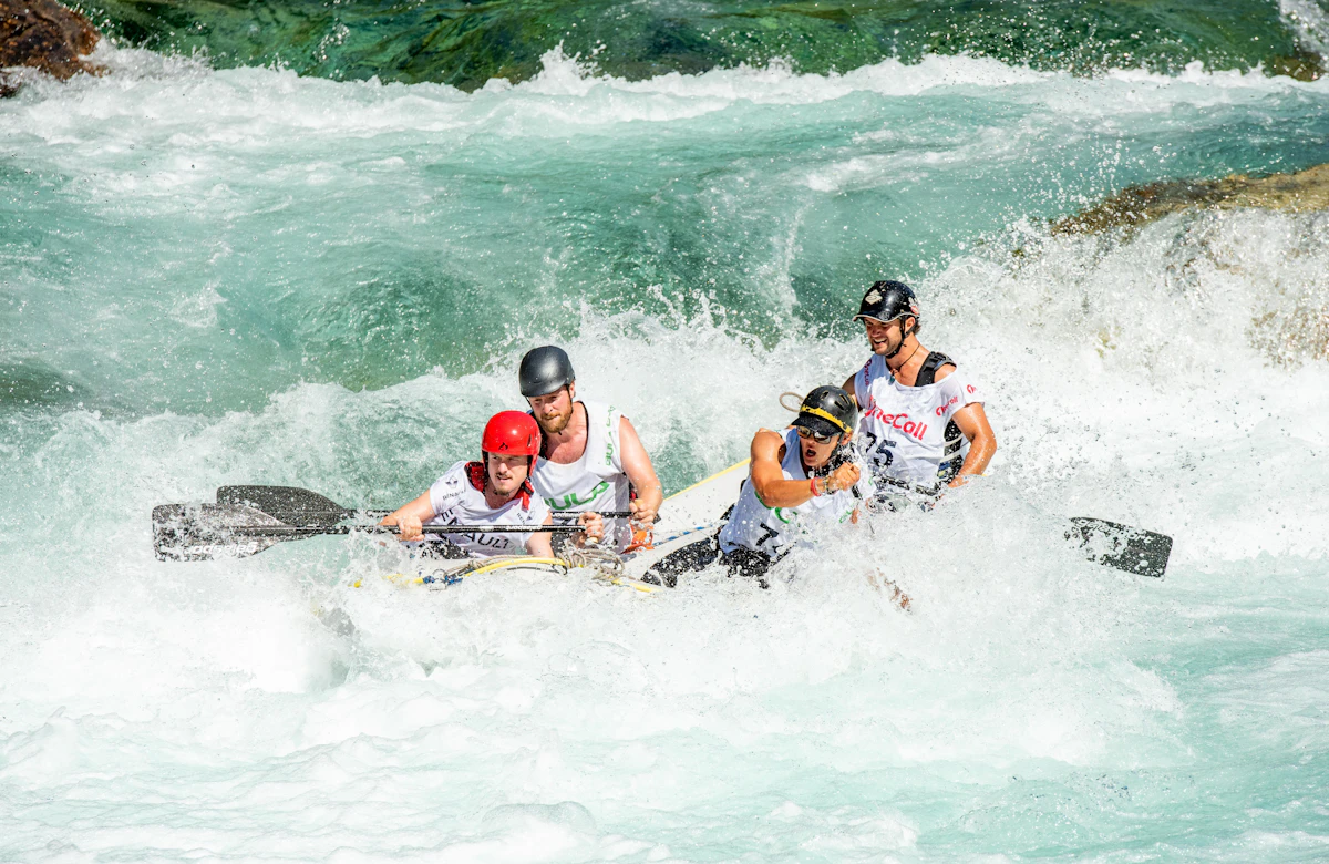
 Whitewater Rafting in Pakistan: Glacial Rapids on Kunhar, Indus, Neelum & Swat Rivers
Conquer exhilarating Grade II to IV+ glacial rapids on Pakistan's premier river runs: the foaming Kunhar River in Kaghan, the emerald Swat River, pine-lined Neelum River in Kashmir, and massive big-water gorges of the upper Indus near Skardu.
 Trekking Route 1-Day Strenuous Trek (7 to 9 Hours round-trip)
 Ansoo Lake Trek (Teardrop Alpine Tarn, 4,245m)
Tucked high in the craggy Himalayan ridges of Kaghan Valley near Malika Parbat, Ansoo Lake is Pakistan's legendary teardrop-shaped glacial tarn (4,245m), reached via an exhilarating, challenging day trek from Lake Saif-ul-Malook.
Trekking Route 2 to 3 Days Wilderness Trek Dagri Bangla Deep Forest Wilderness Trek (2,720m): The Great Galiyat Pine Traverse
Trek deep into the mystical temperate rainforests of Ayubia National Park to Dagri Bangla (2,720m), a historic 1927 British colonial forest lodge surrounded by centuries-old blue pines, leopard sanctuaries, and complete alpine seclusion.
Design a Custom Lulusar Lake (Jewel of Upper Kaghan, 3,410m) Itinerary
Have specific dates, private group preferences, or combining multiple valleys across Khyber Pakhtunkhwa? Our mountain logistics desk crafts tailored private 4x4 departures.
- Private 4x4 Toyota Prado / Land Cruiser convoy
- Certified local mountain guides & porters
- Curated heritage lodges & boutique camps
Frequently Asked Questions About Lulusar Lake (Jewel of Upper Kaghan, 3,410m)
Can normal passenger cars reach Lulusar Lake?
Yes. Lulusar Lake is situated directly alongside the paved National Highway N-15 connecting Naran to Babusar Pass and Chilas. Standard cars, sedans, vans, and tourist buses can drive right up to the lake viewpoints without requiring a 4x4 jeep.
How far is Lulusar Lake from Naran, and how long does the drive take?
Lulusar Lake is located 48 kilometers northeast of Naran bazaar. Driving along the paved highway takes approximately 1.5 to 2 hours, passing Battakundi, Jalkhand, and Besal.
Is boating or swimming allowed in Lulusar Lake?
Swimming and private motor-boating are strictly prohibited for safety and environmental protection. The lake water is freezing glacial meltwater with unpredictable depths reaching over 150 feet, and it serves as the drinking and river water source for downstream communities.
Are there hotels or restaurants near Lulusar Lake?
Basic roadside tea stalls and local tuck shops operate near the lake during summer, serving hot tea, pakoras, and mineral water. Comfortable hotels and restaurants are available at Besal (2 km away), Jalkhand (12 km away), and Battakundi (32 km away).
What is the best time of day to photograph Lulusar Lake?
Early morning (between 7:30 AM and 10:00 AM) is ideal. Winds are calmest during these hours, producing glass-like water that creates stunning mirror reflections of the surrounding snow peaks.
When does Lulusar Lake open and close each year?
The lake and the N-15 highway generally open in early to mid-June when the National Highway Authority (NHA) clears winter snowdrifts. It remains accessible until late October or early November, when heavy winter snow closes the Babusar Pass corridor.