
Essential Destination Profile: Babusar Top
About Babusar Top
Perched at a windswept, cloudswept elevation of 4,173 meters (13,691 feet), Babusar Top (also known as Babusar Pass) is the apex of Kaghan Valley and the historic mountain threshold dividing Khyber Pakhtunkhwa from the Diamer District of Gilgit-Baltistan. Serving as the summer lifeline of northern Pakistani travel along the National Highway N-15, this magnificent mountain pass bypasses the grueling Indus Kohistan highway route, shortening the overland road journey from Islamabad to Gilgit, Hunza, and Skardu by over six to eight hours while delivering some of the most spectacular alpine panoramas in Asia.
Key Destination Snapshot
- Geographic Location: Boundary of Kaghan Valley (KPK) and Diamer District (Gilgit-Baltistan)
- Pass Elevation: 4,173 meters (13,691 feet) above sea level
- Highway Classification: N-15 National Highway (Mansehra-Naran-Jalkhad-Chilas Road)
- Distance from Naran: ~66 kilometers north (~2 hours drive)
- Distance to Chilas (KKH Confluence): ~45 kilometers north (~1.5 hours descent)
- Operational Season: Late June through October (Closed by winter snowpack Nov-May)
- Key Highlights: Nanga Parbat Viewpoint, Lulusar Lake En Route, High-Altitude Tea Stalls, Gittidas Meadows
1. The Historical Legacy of Babusar
Historically known as Babusar after the founder of the Mughal Empire, Zahir-ud-din Muhammad Babur, who explored northern mountain passes in the early 16th century, this lofty gap in the Himalayan crest was used for centuries by nomadic Gujjar and Bakarwal herders moving their sheep, goats, and cattle between the lush pastures of Kaghan and the upper valleys of the Indus. During the British colonial era, a bridle track was constructed across Babusar to link Rawalpindi directly with the military garrison at Gilgit.
Today, the modern paved N-15 highway transforms this historic pack-mule trail into a smooth, scenic alpine thoroughfare. As travelers crest the final series of hairpin switchbacks, the verdant green pine forests of Kaghan Valley give way to vast, treeless alpine tundra carpeted with golden lichens, purple alpine aster, and grazing herds of domestic yaks.
2. En-Route Wonders Along the N-15 Highway
The 66-kilometer drive from Naran up to Babusar Pass is one of the most scenic road corridors in Northern Pakistan, lined with iconic natural landmarks:
| Landmark | Elevation & Location | Scenic & Travel Significance |
|---|---|---|
| Battakundi & Burawai | 2,650m | 16-28 km from Naran | Lush terraced potato fields, rushing Kunhar river rapids, and roadside trout cafes. |
| Jalkhad | 3,140m | 40 km from Naran | Strategic junction where the jeep road branches eastward across Noori Top into Neelum Valley, Kashmir. |
| Besal | 3,260m | 48 km from Naran | High pasture settlement serving as the trekking trailhead for Dudipatsar Lake and Saral Lake. |
| Lulusar Lake | 3,410m | 50 km from Naran | The largest natural lake in Kaghan Valley; a w-shaped sapphire mirror reflecting snowy peaks; origin of the Kunhar River. |
| Gittidas Meadows | 3,650m | 58 km from Naran | Expansive sub-alpine wetlands famed for traditional stone shepherd huts, wild rhubarb, and summer nomad encampments. |
| Babusar Pass Crest | 4,173m | 66 km from Naran | The windswept summit marker, offering 360-degree vistas of the western Himalayas and Karakoram. |
3. The 360-Degree Mountain Panorama: Glimpses of Nanga Parbat
At the apex of Babusar Top, travelers step into a boundless high-altitude amphitheater. On exceptionally clear summer mornings before cloud buildup, looking northeast past the barren brown hills of Chilas reveals the colossal, ice-clad pyramid of Nanga Parbat (8,126 meters / 26,660 feet)—the 'Killer Mountain' and the ninth highest peak on Earth—towering like an impenetrable white fortress against the horizon.
To the south and west, the jagged serrated ridge of Malika Parbat (5,290m) and the snow-clad peaks dividing Kaghan from Azad Kashmir form a dramatic backdrop. The intense contrast between the lush green southern slopes of Khyber Pakhtunkhwa and the stark, arid, rain-shadow canyons of the Indus gorge to the north illustrates the dramatic climatological boundary forged by the Himalayas.
4. Driving Safety: Taming the Hairpin Gradients
While the N-15 highway is fully asphalted, the steep gradient between Besal (3,260m), Babusar Top (4,173m), and the descent into Chilas (1,265m) demands strict driving discipline:
- Engine Compression & Low Gear Descent: When descending either side of Babusar Pass, drivers must shift into low gear (1st or 2nd gear in manual, or 'L' / '2' / Sport Mode in automatics). Relying solely on continuous foot braking will overheat brake pads within 15 minutes, leading to catastrophic brake failure.
- Radiator & Engine Overheating: Climbing 3,000 vertical meters from Chilas or 1,800 meters from Naran strains automobile cooling systems. Turn off vehicle air conditioning during the final steep 15-kilometer ascent and monitor temperature gauges.
- Night Driving Restrictions: For traveler safety, local police checkpoints at Besal (KPK side) and Zero Point Chilas (GB side) generally restrict civilian traffic from crossing Babusar Pass after 06:00 PM. Plan your journey to cross between 08:00 AM and 04:00 PM.
- Winter Snow & Landslide Hazards: Never attempt crossing before official seasonal opening announcements by the National Highway Authority (NHA), as unplowed snowdrifts and sheet ice make the road impassable.
5. Seasonal Operating Timeline
Because Babusar Pass receives up to 15 to 25 feet of heavy winter snowpack, its operational window is strictly seasonal:
| Month | Pass Status | Day / Night Temperature | Travel Condition |
|---|---|---|---|
| November to Early June | Strictly CLOSED to all vehicular traffic | Sub-zero / Down to -20°C | Buried under deep snowpack; traffic routed via KKH Kohistan. |
| Late June (Opening Window) | NHA snow-cutting bulldozers clear single-lane corridors through massive ice walls | 8°C to 14°C / -2°C to 2°C | Dramatic snow canyon walls; brisk chilly winds; jackets essential. |
| July to August (Peak Summer) | Fully open; double-lane asphalt; vibrant nomad life; busy tourist transit | 14°C to 20°C / 2°C to 6°C | Optimal road conditions; tea and pakora stalls buzzing at the pass. |
| September to Mid-October | Open with clear skies; crisp autumn weather; first light snow flurries | 8°C to 15°C / -4°C to 0°C | Unrivaled mountain visibility; fewer crowds; warm down coats needed. |
6. High-Altitude Amenities & Cultural Flavor
At the pass summit, enterprising local vendors operate temporary summer stalls offering steaming cups of cardamom chai, spicy onion pakoras, roasted corn cobs (bhutta), and warm chicken noodle soup. Handwoven woolen shawls, local honey, and traditional Chitrali caps (pakols) are also sold. Taking a break to sip hot tea while soaking in the frigid, razor-thin mountain air is an enduring tradition of the Pakistani road trip.
Key Highlights & Geographic Significance
Tours & Treks in Babusar Top
Handcrafted guided departures, private 4x4 road journeys, and alpine trekking routes exploring Babusar Top and the wider Khyber Pakhtunkhwa mountain corridor.
 Tour Package 5 Days / 4 Nights
 5-Day Swat, Kalam & Malam Jabba Scenic Tour Package
Discover Pakistan's 'Switzerland of the East' on our signature 5-day private tour. Ride the chairlifts at Malam Jabba ski resort, explore ancient Gandhara Buddhist stupas, and take a 4x4 jeep safari through Ushu Forest to turquoise Mahodand Lake.
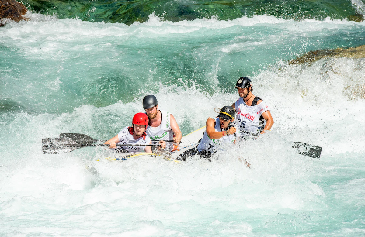 Tour Package 1-Day Day Trips to 3-Day Weekend River Expeditions
 Whitewater Rafting in Pakistan: Glacial Rapids on Kunhar, Indus, Neelum & Swat Rivers
Conquer exhilarating Grade II to IV+ glacial rapids on Pakistan's premier river runs: the foaming Kunhar River in Kaghan, the emerald Swat River, pine-lined Neelum River in Kashmir, and massive big-water gorges of the upper Indus near Skardu.
 Trekking Route 1-Day Strenuous Trek (7 to 9 Hours round-trip)
 Ansoo Lake Trek (Teardrop Alpine Tarn, 4,245m)
Tucked high in the craggy Himalayan ridges of Kaghan Valley near Malika Parbat, Ansoo Lake is Pakistan's legendary teardrop-shaped glacial tarn (4,245m), reached via an exhilarating, challenging day trek from Lake Saif-ul-Malook.
Trekking Route 2 to 3 Days Wilderness Trek Dagri Bangla Deep Forest Wilderness Trek (2,720m): The Great Galiyat Pine Traverse
Trek deep into the mystical temperate rainforests of Ayubia National Park to Dagri Bangla (2,720m), a historic 1927 British colonial forest lodge surrounded by centuries-old blue pines, leopard sanctuaries, and complete alpine seclusion.
Design a Custom Babusar Top Itinerary
Have specific dates, private group preferences, or combining multiple valleys across Khyber Pakhtunkhwa? Our mountain logistics desk crafts tailored private 4x4 departures.
- Private 4x4 Toyota Prado / Land Cruiser convoy
- Certified local mountain guides & porters
- Curated heritage lodges & boutique camps
Frequently Asked Questions About Babusar Top
What is the elevation of Babusar Top and why is it significant?
Babusar Top sits at 4,173 meters (13,691 feet) above sea level. It is the highest geographic point in the Kaghan Valley and acts as the natural border between Khyber Pakhtunkhwa and Gilgit-Baltistan. The pass carries the paved N-15 highway, providing the fastest and most scenic summer overland route between Islamabad and Gilgit/Hunza/Skardu.
When does Babusar Pass open and close each year?
Babusar Pass typically opens in late June or early July after the National Highway Authority (NHA) clears winter snowdrifts. It remains open throughout the summer and early autumn, before closing again in late October or early November following the first major winter snowstorms.
Can standard sedan cars and family vehicles cross Babusar Top?
Yes, absolutely. The N-15 highway is fully paved with smooth asphalt. Any well-maintained standard car, sedan, hatchback, or crossover can cross Babusar Top during the open summer season. However, drivers must ensure their vehicle's brakes, radiator cooling system, and tires are in excellent working order.
How far is Babusar Top from Naran and Chilas?
Babusar Top is approximately 66 kilometers north of Naran (about a 2-hour drive) and roughly 45 kilometers south of Chilas on the Karakoram Highway (about a 1.5-hour steep downhill drive).
Can you see Nanga Parbat from Babusar Top?
Yes. On clear mornings with low cloud cover, looking northeast across the Indus gorge toward Diamer reveals the immense, snow-covered pyramid summit of Nanga Parbat (8,126m), the world's ninth-highest mountain.
What are the most critical safety tips when driving down Babusar Pass?
The most vital rule is to descend using engine braking in low gear (1st or 2nd gear). Continuously riding your vehicle's brakes will cause severe brake overheating, pad crystallization, and sudden brake failure. Also, avoid travel after sunset as police checkpoints close the pass at night for passenger safety.