
Essential Destination Profile: Ganga Choti Alpine Peak (Bagh, Azad Kashmir, 3,044m)
About Ganga Choti Alpine Peak (Bagh, Azad Kashmir, 3,044m)
Rising in a remarkably symmetrical, emerald-green pyramidal cone at an altitude of 3,044 meters (9,987 ft) above sea level, Ganga Choti is universally celebrated as the most iconic, picturesque, and accessible mountain summit in the Bagh District of Azad Jammu & Kashmir. Situated at the historic mountain pass of Sudhan Gali (2,200m), this towering grassy sentinel forms the high geographic divide between the Bagh and Muzaffarabad valleys. Named after local Kashmiri folklore referencing a sparkling glacial spring that once bubbled near its upper flanks, Ganga Choti is renowned for its vast, treeless meadows carpeted in vibrant yellow daisies, wild buttercups, and alpine clover. Unlike remote high-altitude peaks that require days of arduous expedition trekking, Ganga Choti offers one of Pakistan's most rewarding day hikes: ascending from the pine-scented colonial rest houses of Sudhan Gali, hikers follow a well-trodden grassy ridge trail that climbs approximately 850 vertical meters to reach the summit in just 1.5 to 2.5 hours. Standing atop the windswept summit crest grants an extraordinary 360-degree amphitheater: looking east reveals the snow-capped serrated ridge of the Pir Panjal Range, looking south overlooks the rolling hills of Poonch and Rawalakot, while looking northwest reveals the deep wooded gorge of the Jhelum River.
Peak Highlights & Alpine Wonders
- Iconic Green Pyramidal Summit (3,044m): Climb the distinctive cone-shaped mountain whose rolling emerald slopes dominate the skyline of Azad Kashmir.
- Breathtaking 360-Degree Panorama: Gaze unimpeded across the Pir Panjal Range, Bagh Valley, Poonch River basin, and the misty gorges of Muzaffarabad.
- Accessible 2-Hour Summit Hike: A rewarding, non-technical mountain climb achievable in a single afternoon from the roadhead pass of Sudhan Gali.
- Wildflower Meadows of Sudhan Gali: Wander through blooming sub-alpine meadows grazed by mountain ponies and sheep herds under clear blue Himalayan skies.
- Four-Season Mountain Destination: Enjoy refreshing summer breezes (18°C–22°C) in July and August, or exhilarating winter snowshoeing under 3 to 5 feet of powder.
The Hiking Route: Sudhan Gali Pass to Ganga Choti Summit
The trail from Sudhan Gali to the summit of Ganga Choti covers approximately 3.5 kilometers each way (7 km round-trip):
- Trailhead at Sudhan Gali (2,200m): Begin at the mountain bazaar and AJK Tourism rest house area in Sudhan Gali. The path departs the paved road and ascends through fragrant Himalayan blue pine and spruce woodlands. Local mountain ponies are available for hire for children and seniors. Walking time: 30 minutes.
- The Mid-Ridge Alpine Pastures (2,600m): Above the tree line, the trail emerges into wide, sweeping grassy slopes. The gradient steepens into gentle switchbacks. Hikers are treated to sweeping views of the terraced agricultural hamlets of Bagh below. Stop at rustic shepherd tea huts for fresh buttermilk (lassi) or hot chai. Walking time: 45 minutes.
- The Final Pyramidal Cone Push (2,850m to 3,044m): The final stretch ascends the steep, grassy northern face of the cone. The path is well-defined but requires steady footing on damp turf. Reach the flat, grassy summit crest marked by a small stone shelter and survey cairn. Spend an hour taking in the breathtaking 360-degree mountain horizon. Walking time: 45 minutes.
- Descent to Sudhan Gali: The descent is smooth and fast, retracing the grassy ridge down to Sudhan Gali in about 1 hour to 1 hour and 15 minutes.
| Hike Stage | Elevation | Distance / Time | Terrain & Visual Features |
|---|---|---|---|
| Sudhan Gali Pass | 2,200m | Starting Point | Paved road terminal, local hotels, pine woods |
| Lower Pine Glade | 2,450m | 1.2 km / 30 Mins | Dense pine forest trail, gentle gradient |
| Mid-Ridge Meadow | 2,700m | 1.2 km / 45 Mins | Open alpine grassland, shepherd huts, tea stalls |
| Ganga Choti Summit | 3,044m | 1.1 km / 45 Mins | Steep grassy cone, 360° Pir Panjal & Kashmir panorama |
| Descent to Sudhan Gali | 2,200m | 3.5 km / 1.2 Hours | Smooth grassy downhill retracing steps |
Comparing Ganga Choti with Other Azad Kashmir Viewpoints
Understanding how Ganga Choti compares to other prominent mountain summits and ridges in Azad Kashmir:
| Mountain Viewpoint | Summit Elevation | Hike Duration | Trail Character | Unique Feature |
|---|---|---|---|---|
| Ganga Choti (Bagh) | 3,044m | 1.5 to 2.5 Hours | Grassy alpine cone & ridge | Distinctive green pyramid & Pir Panjal vistas |
| Toli Peer (Rawalakot) | 2,666m | 15 Mins (from road) | Bald rolling grassy ridge | Paragliding takeoff & cloud inversions |
| Pir Chinasi (Muzaffarabad) | 2,900m | Direct Road Access | Paved road to summit crest | Sacred Sufi shrine & paragliding |
| Mushkpuri Top (Galiyat) | 2,800m | 2 to 2.5 Hours | Pine woodland & meadow | Views of Jhelum River & Murree hills |
Best Season, Road Access & Practical Tips
The optimal hiking season for Ganga Choti is May through October. July and August offer lush green slopes and vibrant wildflower blooms with comfortable daytime highs (18°C to 24°C). September and October feature crisp mountain air and clear skies. In winter (December to February), the cone is covered in deep snow, attracting winter mountaineers. From Islamabad, travel via the Murree Expressway to Kohala, follow the paved highway to Bagh (3.5 hours), then take the 20-kilometer paved mountain link road up to Sudhan Gali (45 minutes). Standard passenger cars can reach Sudhan Gali easily.
Key Highlights & Geographic Significance
Tours & Treks in Ganga Choti Alpine Peak (Bagh, Azad Kashmir, 3,044m)
Handcrafted guided departures, private 4x4 road journeys, and alpine trekking routes exploring Ganga Choti Alpine Peak (Bagh, Azad Kashmir, 3,044m) and the wider Azad Kashmir mountain corridor.
 Tour Package 5 Days / 4 Nights (from Muzaffarabad or Islamabad)
 Gurez Valley (Kel to Taobat) Upper Neelum Tour
Embark on an exhilarating 4x4 expedition through the pristine frontier of Upper Neelum, from the fairy-tale plateau of Arang Kel along the roaring Kishanganga River to the untouched timber village of Taobat.
 Tour Package 1-Day Day Trips to 3-Day Weekend River Expeditions
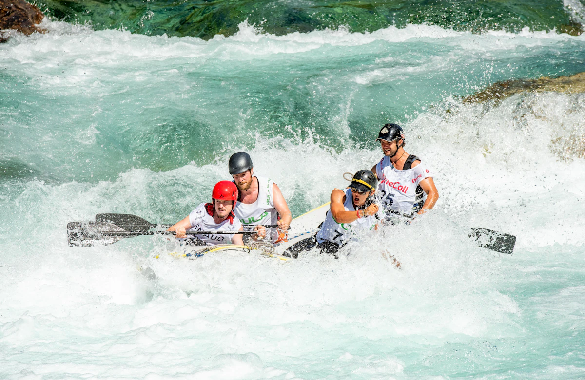
 Whitewater Rafting in Pakistan: Glacial Rapids on Kunhar, Indus, Neelum & Swat Rivers
Conquer exhilarating Grade II to IV+ glacial rapids on Pakistan's premier river runs: the foaming Kunhar River in Kaghan, the emerald Swat River, pine-lined Neelum River in Kashmir, and massive big-water gorges of the upper Indus near Skardu.
 Trekking Route 1 to 2 Days (Day hike or overnight meadow stay)
 Arang Kel Trek & Cable Car (Neelum Valley, 2,554m)
Ascend to the breathtaking 'Pearl of Neelum Valley': experience the dramatic aerial cable car over the roaring river gorge, followed by a scenic pine-shaded alpine hike to the emerald wooden village plateau of Arang Kel (2,554m).
Trekking Route 5 to 6 Days (Chillum Chowki to Minimarg & return) Burzil Pass Historical Caravan Trek (Astore to Kashmir, 4,100m)
Trek the legendary 2,000-year-old Silk Road caravan route crossing Burzil Pass (4,100m): traverse from Chillum Chowki in Astore across windswept alpine tundras into the secret paradise of Minimarg, Rainbow Lake, and Kamri.
Design a Custom Ganga Choti Alpine Peak (Bagh, Azad Kashmir, 3,044m) Itinerary
Have specific dates, private group preferences, or combining multiple valleys across Azad Kashmir? Our mountain logistics desk crafts tailored private 4x4 departures.
- Private 4x4 Toyota Prado / Land Cruiser convoy
- Certified local mountain guides & porters
- Curated heritage lodges & boutique camps
Frequently Asked Questions About Ganga Choti Alpine Peak (Bagh, Azad Kashmir, 3,044m)
Where is Ganga Choti located and how high is it?
Ganga Choti is located in the Bagh District of Azad Jammu & Kashmir, near the high mountain pass of Sudhan Gali. It stands at an elevation of 3,044 meters (9,987 feet) above sea level.
How difficult is the hike to the summit of Ganga Choti?
The hike is rated Moderate. It covers approximately 3.5 kilometers with an elevation gain of about 850 vertical meters from Sudhan Gali (2,200m) to the summit (3,044m). The trail is grassy and non-technical, taking about 1.5 to 2.5 hours to reach the top.
Can regular cars reach the trailhead at Sudhan Gali?
Yes. The road from Islamabad via Kohala and Bagh to Sudhan Gali is fully paved and in good condition. Standard passenger sedans, hatchbacks, and family vans can easily drive all the way to Sudhan Gali without needing a 4x4 vehicle.
Are horses or ponies available for the hike?
Yes. Local horse handlers at Sudhan Gali provide guided pony rides up the mountain trail for children, elderly visitors, or hikers who prefer to ride rather than walk.
What accommodation is available in Sudhan Gali?
Sudhan Gali features the historic AJK Tourism Department Rest House, several comfortable private guest houses, and family hotels. Wilderness tent camping is also popular on the grassy meadows beneath the peak.
What is the best time of year to climb Ganga Choti?
The best time is from May to October for warm, sunny weather and green pastures. Summer daytime temperatures are pleasant (18°C to 24°C). Winter (December to February) offers deep snow and snow hiking for adventure enthusiasts.